📌 Key Takeaways
- The synthetic aperture radar LEO commercial market has moved from a niche defense capability to a multi-operator race, led by ICEYE, Capella Space, and Umbra, all flying active constellations as of 2026.
- ICEYE reported roughly 35+ satellites on orbit as of mid-2024 and closed a $1.1 billion funding round in June 2026, according to trade press, to accelerate production toward a larger constellation.
- The U.S. National Reconnaissance Office extended its Stage III commercial radar contracts with Capella, ICEYE, and Umbra through July 2026, formalizing government reliance on commercial SAR data.
- Analyst estimates for the space-sector SAR market cluster around $1.9 billion in 2026, with the broader SAR imagery and hardware market variously sized between $5 billion and $9 billion depending on scope, growing at a compound annual rate near 13-14% into the early 2030s.
Optical Earth observation built the commercial remote sensing industry, but it has one structural limitation that no amount of resolution improvement can fix: it needs sunlight and clear skies. Radar does not. That gap has turned synthetic aperture radar (SAR) from a defense-only capability into one of the fastest-growing segments of the low Earth orbit economy, as a cohort of venture-backed operators proves that all-weather, day-and-night imaging can be delivered commercially, repeatedly, and at a price government and enterprise buyers will pay.
On this page
- The Synthetic Aperture Radar LEO Commercial Landscape in 2026
- ICEYE, Capella, and Umbra: Mapping the SAR Constellation Race
- Why Synthetic Aperture Radar LEO Commercial Demand Is Accelerating
- Market Size and Funding Trends
- SAR vs. Optical: Complementary, Not Competing
- Resolution, Revisit, and the Technology Race
- Risks and Bottlenecks: Data Costs, Processing, and Sovereignty
- Industry Implications
- What to Watch
Three companies — ICEYE, Capella Space, and Umbra — now anchor the sector, each flying operational constellations, each holding government contracts, and each competing on a different axis: constellation size, resolution, or cost per tasking. Behind them sits a wave of newer entrants and sovereign programs seeking their own radar eyes in orbit. This piece maps the competitive landscape, sizes the market as of 2026, and explains why SAR is increasingly framed not as an alternative to optical imagery but as its necessary complement.
The Synthetic Aperture Radar LEO Commercial Landscape in 2026
SAR works by transmitting microwave pulses toward the ground and reconstructing an image from the reflected signal’s phase and amplitude, using the satellite’s own motion to synthesize an effective antenna far larger than the physical one on board. The technique dates to airborne and government radar programs of the Cold War era, but only in the past decade has it become small, cheap, and power-efficient enough to fly on smallsat buses in large numbers.
That miniaturization is the entire story of the commercial SAR boom. A single legacy military radar satellite could cost hundreds of millions of dollars and take years to build. Today’s commercial SAR smallsats, built by companies like ICEYE and Capella, weigh under 200 kilograms, cost a fraction of that, and can be manufactured on a production line — which is precisely what enables constellation-scale deployment rather than one-off missions.
How SAR Differs from Optical Imaging
Optical satellites, including the large constellations built for high-cadence Earth imaging, are blind at night and degraded or blocked by cloud cover — a real constraint given that large portions of the tropics and mid-latitudes are cloud-covered on any given day, according to atmospheric science estimates cited across the EO industry. SAR penetrates cloud, smoke, and darkness because it supplies its own illumination and operates at wavelengths clouds do not meaningfully attenuate.
The tradeoff is interpretability. SAR imagery encodes surface roughness, moisture, and dielectric properties rather than true color, which makes it harder to read visually but extremely valuable for change detection, ship and vehicle tracking, flood mapping, and subsidence monitoring — tasks where consistent, weather-independent revisit matters more than a photograph-like image.
ICEYE, Capella, and Umbra: Mapping the SAR Constellation Race
The commercial SAR field has consolidated around a recognizable “big three,” though the field beneath them is thickening with government-backed and sovereign entrants. Each of the three leaders has staked out a distinct strategic position rather than competing on identical specifications.
ICEYE: Scale and Vertical Integration
Finland-founded, now globally structured ICEYE has pursued the largest constellation of the three, with roughly 35-plus satellites reported on orbit as of mid-2024 and continued launches since. The company closed a $1.1 billion funding round in June 2026, per trade press reporting, explicitly earmarked to expand satellite production and constellation scale — a figure that, if confirmed in ICEYE’s own disclosures, would rank among the largest single raises in the commercial EO sector to date. ICEYE has marketed itself on frequent revisit and a natural-disaster and insurance-analytics business line layered on top of its defense contracts.
Capella Space: Resolution and U.S. Government Focus
Capella Space has built its position around high-resolution imaging (sub-half-meter in its finest mode) and a tight relationship with U.S. national security customers. Company materials have described a roadmap toward a constellation of around three dozen satellites to enable near-hourly revisit over priority areas, though actual on-orbit counts have moved more incrementally as the company balances government tasking commitments against commercial expansion.
Umbra: Resolution-First Niche Positioning
Umbra has taken the smallest-constellation, highest-resolution approach, marketing imagery down to roughly 16-centimeter resolution — a figure the company positions as best-in-class for commercial SAR — while flying a leaner satellite count than ICEYE or Capella. That positions Umbra as the specialist for applications where fine detail matters more than area coverage or revisit frequency.
The clearest signal of the sector’s maturation came in December 2024, when the U.S. National Reconnaissance Office narrowed its Stage III commercial radar imagery contract to exactly these three companies — Capella, ICEYE, and Umbra — extending the performance period through July 2026. [INTERNAL LINK: government EO procurement trends → NRO commercial imagery strategy article] That narrowing signals both validation (these three cleared a rigorous government bar) and consolidation risk for anyone outside the trio.
Why Synthetic Aperture Radar LEO Commercial Demand Is Accelerating
Demand for synthetic aperture radar LEO commercial capacity is being pulled from two directions simultaneously: government intelligence budgets seeking resilient, diversified sourcing, and commercial verticals that need weather-independent monitoring at a cadence optical alone cannot deliver.
Defense and Intelligence Diversification
The war in Ukraine has been widely cited across the industry as an inflection point for commercial SAR adoption, with radar imagery used to track military vehicle movements and infrastructure damage regardless of cloud cover or time of day. Government buyers, wary of relying on a small number of exquisite national assets, have moved toward multi-vendor commercial contracts as a hedge — precisely the logic behind the NRO’s Stage III structure.
Commercial Verticals: Insurance, Maritime, Infrastructure
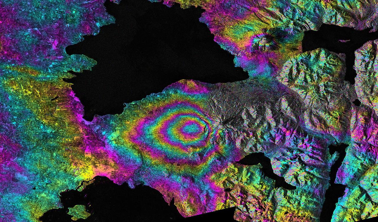
Insurers use SAR-derived flood and storm-damage maps to accelerate claims processing after weather events, since radar can image a disaster zone through the same storm clouds that ground optical tasking. Maritime domain awareness customers use SAR to detect vessels that have disabled their automatic identification system transponders — a use case optical constellations cannot reliably serve at night or under cloud. Infrastructure monitoring customers use interferometric SAR (InSAR) to detect millimeter-scale ground subsidence around dams, pipelines, and mines over time, a capability with no optical equivalent at all.
Market Size and Funding Trends
Sizing the commercial SAR market precisely is difficult because research firms scope it differently — some count only space-segment SAR, others fold in ground processing, analytics software, and terrestrial radar applications. Analyst estimates for the space-sector SAR market cluster near $1.9 billion in 2026, per Coherent Market Insights, while broader SAR market definitions from other research houses range from roughly $5 billion to $9 billion for the same year. What is consistent across estimates is the growth trajectory: a compound annual growth rate in the 13-14% range through the early-to-mid 2030s, driven by constellation proliferation and expanding civilian applications.
| Operator | Approx. Satellites On-Orbit (2026) | Best Resolution (Reported) | Primary Customer Base |
|---|---|---|---|
| ICEYE | 35+ (mid-2024 figure, expanding) | ~25 cm | Defense, insurance, disaster response |
| Capella Space | ~10-15 operational | ~0.5 m | U.S. national security, government |
| Umbra | ~8-10 operational | ~16 cm | Defense, high-precision analytics |
Funding has followed the contract momentum. ICEYE’s reported $1.1 billion round in June 2026 stands out as the largest disclosed SAR-specific raise to date, and its scale reflects investor conviction that constellation size, not just image quality, is becoming the durable competitive moat in this sector — echoing the capital-intensity dynamics that have defined the broader LEO constellation race. [INTERNAL LINK: capital intensity of constellation buildouts → LEO satellite manufacturing economics article]
SAR vs. Optical: Complementary, Not Competing
Industry framing has shifted away from treating SAR as a competitor to optical Earth observation and toward treating the two as complementary layers of a single monitoring stack. Optical imagery remains superior for human interpretability, spectral analysis (crop health, mineral identification), and cases where color and texture carry the signal. SAR wins on reliability of capture — it does not miss a tasking window because of weather — and on physical measurements optical cannot make, such as ground deformation or soil moisture.
Resolution, Revisit, and the Technology Race
Two variables define competitive positioning in commercial SAR: resolution (spatial detail) and revisit (how often a given point on Earth can be imaged). These are in tension — spotlight modes that achieve Umbra’s sub-20-centimeter class resolution generally trade off swath width and dwell time, limiting area coverage, while wide-area surveillance modes sacrifice fine detail for broader, more frequent coverage.
Non-Earth-Imaging Applications
A smaller but notable subset of SAR development is directed at non-Earth-imaging applications — using radar-derived techniques for satellite proximity operations and space domain awareness. That is a distinct engineering problem from ground-imaging SAR, but it draws on the same core antenna and signal-processing expertise, and several SAR-adjacent teams have begun exploring it as a diversification path beyond the core commercial radar imagery market. [INTERNAL LINK: space domain awareness capabilities → SDA constellation article]
Risks and Bottlenecks: Data Costs, Processing, and Sovereignty
Despite the growth narrative, commercial SAR faces real friction points. Raw SAR data requires substantially more processing power and specialized expertise to convert into usable analytics than optical imagery does, which has kept per-image and per-tasking prices well above equivalent optical products and limited the addressable customer base largely to government, insurance, and large enterprise buyers rather than a broader self-serve market.
Government dependency is a double-edged sword. The NRO’s Stage III contracts have been a major revenue and legitimacy driver for Capella, ICEYE, and Umbra, but that same concentration means a change in U.S. procurement posture, budget appropriations, or the still-unresolved “program of record” question for fiscal 2026 — an issue industry stakeholders have flagged as unfinished business — could materially affect all three companies’ near-term revenue visibility at once.
Sovereignty concerns are a rising factor as well. A growing number of national governments — beyond the U.S. and Finland-linked ICEYE’s home base — are pursuing their own sovereign SAR programs rather than relying solely on foreign commercial operators for strategically sensitive radar coverage, a dynamic that could cap addressable market growth for the current leading trio even as overall global SAR capacity expands.
Industry Implications
For enterprise buyers: Insurance, maritime, and infrastructure customers should evaluate SAR not as a substitute for optical imagery but as a reliability layer — the sensor that guarantees a usable pass regardless of weather. Multi-sensor tasking contracts that blend SAR and optical are increasingly the default rather than the exception for mission-critical monitoring.
For government and defense procurement: The NRO’s decision to formalize a three-vendor commercial radar pool through Stage III signals a broader shift toward diversified, redundant commercial sourcing over reliance on a small number of exquisite national assets. Other allied governments are likely to replicate this multi-vendor procurement model as sovereign SAR ambitions grow.
For investors: ICEYE’s reported $1.1 billion round in June 2026 suggests capital markets are rewarding constellation scale over incremental sensor improvements, mirroring the economics seen elsewhere in the LEO constellation buildout. Expect continued consolidation pressure on SAR operators outside the leading trio that lack comparable government contract validation.
For competing optical EO providers: The complementarity trend between SAR and optical imagery makes standalone optical offerings less defensible for mission-critical, all-weather use cases, pushing optical-first operators toward partnerships, acquisitions, or in-house SAR development to remain competitive across the full monitoring stack.
What to Watch
- ☐ Whether the NRO’s fiscal 2026 budget establishes a formal “program of record” for commercial radar imagery, resolving the funding uncertainty industry stakeholders flagged through mid-2026.
- ☐ ICEYE’s satellite production ramp following its reported $1.1 billion June 2026 raise, and whether on-orbit counts materially exceed the mid-2024 baseline of roughly 35 satellites by year-end 2026.
- ☐ Additional sovereign SAR program announcements from governments seeking independence from the U.S.-anchored commercial SAR trio through 2026-2027.
- ☐ Further consolidation or acquisition activity among smaller SAR entrants that fail to win NRO Stage III-equivalent validation.
- ☐ Expansion of fused optical-SAR tasking contracts as large EO platform providers integrate radar capacity into standard monitoring packages.
Frequently Asked Questions
What makes synthetic aperture radar different from optical satellite imagery?
SAR transmits its own microwave signal and reconstructs an image from the reflection, allowing it to image through cloud cover, smoke, and darkness — conditions that block optical sensors entirely. The tradeoff is that SAR imagery is harder to interpret visually and requires more specialized processing than a standard optical photograph.
Who are the leading commercial SAR satellite operators in 2026?
ICEYE, Capella Space, and Umbra are the three companies most consistently cited as leaders in the synthetic aperture radar LEO commercial market, a position reinforced by the U.S. National Reconnaissance Office narrowing its Stage III commercial radar contract to exactly these three vendors, extended through July 2026.
How big is the commercial SAR market?
Estimates vary by scope: analyst figures put the space-sector SAR market near $1.9 billion in 2026, while broader definitions including ground processing and analytics range from roughly $5 billion to $9 billion for the same year, according to differing market research firms. Most estimates converge on a compound annual growth rate near 13-14% through the early-to-mid 2030s.
What industries use commercial SAR data besides defense?
Insurance companies use SAR for rapid post-storm and flood damage assessment, maritime security firms use it to detect vessels with disabled tracking transponders, and infrastructure operators use interferometric SAR to monitor millimeter-scale ground subsidence around dams, pipelines, and mines over time.
Is SAR replacing optical Earth observation satellites?
No — industry consensus treats SAR and optical as complementary rather than competing. Optical remains preferred for color, spectral, and interpretability-driven use cases, while SAR provides weather-independent reliability and physical measurements like ground deformation that optical sensors cannot capture, leading to growing fused-tasking contracts that use both.
Data Sources
- Breaking Defense, “And then there were 3: NRO extends contracts for radar imagery to Capella, ICEYE, Umbra,” December 2024
- The Defense Post, “ICEYE to Boost Satellite Production With $1.1B Funding Round,” June 2026
- NewSpace Index, Umbra and ICEYE constellation tracking pages, accessed 2026
- Coherent Market Insights, “Synthetic Aperture Radar in Space Sector Market Size 2026-2033”
- Global Market Insights, “Synthetic Aperture Radar Market Size & Share 2026-2035”
- Via Satellite, “Government is Behind in Creating a Program of Record for Commercial Satellite Imagery,” July 2024
Figures dated 2026; verify before citing.